
|
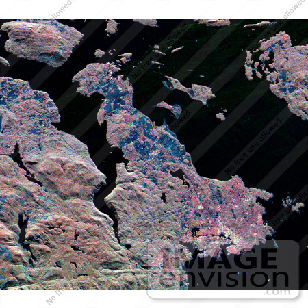
NASA radar image of the southern end of Vancouver Island on the west coast of Canada. The white area in the lower right is the city of Victoria, the capital of the province of British Columbia. The three radar frequencies help to distinguish different land use patterns. The bright pink areas are suburban regions, the brownish areas are forested regions, and blue areas are agricultural fields or forest clear-cuts. Founded in 1843 as a fur trading post, Victoria has grown to become one of western Canada's largest commercial centers. In the upper right is San Juan Island, in the state of Washington. The Canada/U.S. border runs through Haro Strait, on the right side of the image, between San Juan Island and Vancouver Island. Photo Credit: NASA/JPL [0003-0701-1018-5905] by 0003
|
Keywords
bc, british columbia, canada, from space, geography, haro strait, jpl, nasa, san juan island, vancouver island, victoria, victoria canada from space, victoria from space, view from space
|
|


