
|
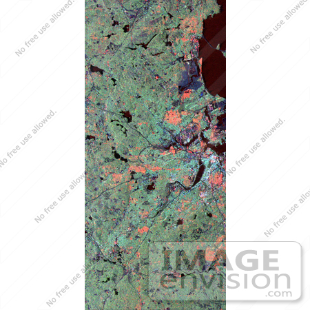
NASA image of Boston from space. This radar image of the area surrounding Boston, Mass., shows how a spaceborne radar system distinguishes between densely populated urban areas and nearby areas that are relatively unsettled. The bright white area at the right center of the image is downtown Boston. The wide river below and to the left of the city is the Charles River in Boston's Back Bay neighborhood. The dark green patch to the right of the Back Bay is Boston Common. A bridge across the north end of Back Bay connects the cities of Boston and Cambridge. The light green areas that dominate most of the image are the suburban communities surrounding Boston. The many ponds that dot the region appear as dark irregular spots. Many densely populated urban areas show up as red in the image due to the alignment of streets and buildings to the incoming radar beam. North is toward the upper left. Photo Credit: NASA/JPL [0003-0701-1019-1931] by 0003
|
Keywords
back bay, boston, boston common, boston from space, boston mass, boston massachusetts, cambridge, charles river, from space, geography, jpl, mass, massachusetts, massachusetts from space, nasa, view from space
|
|


