
|
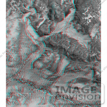
3d anaglyph image of Kamchatka Peninsula in Russia. Red-blue glasses are required to see the 3-D effect. The topographic data are from the first C-band mapping swath of the Shuttle Radar Topography Mission(SRTM). Images from the optical Landsat satellite are overlain on the SRTM topography data. The meandering channel of the Tigil River is seen along the bottom of the image, at the base of steep cliffs. In the middle left of the image, a terrace indicates recent uplift of the terrain and downcutting by the river. High resolution SRTM topographic data will be used by geologists and hydrologists to study the interplay of tectonic uplift and erosion. Photo Credit: NASA/JPL/NIMA [0003-0701-0820-0903] by 0003
|
Keywords
3d, anaglyph, anaglyphs, geography, jpl, kamchatka peninsula, nasa, russia, tigil river
|
|


