
|
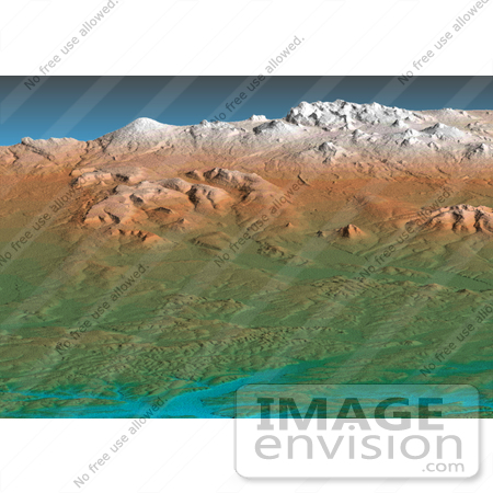
Image of the Kamchatka Peninsula, Russia. The data are from the first C-band mapping swath of the Shuttle Radar Topography Mission (SRTM). In the foreground is the broad, flat floodplain of the Amanina River, shown in blue. In background of the image is the Sredinnyy Khrebet, the volcanic mountain range that makes up the "spine" of the peninsula. The cluster of hills in the upper right is a field of small dormant volcanoes. Photo Credit: NASA/JPL/NIMA [0003-0701-0819-5351] by 0003
|
Keywords
amanina river, geography, jpl, kamchatka peninsula, nasa, russia, sredinnyy khrebet
|
|


