
|
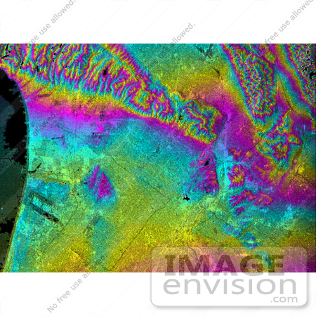
Radar image showing the relationships of the dense urban development of Los Angeles and the natural contours of the land. The image includes the Pacific Ocean on the left, the flat Los Angeles Basin across the center, and the steep ranges of the Santa Monica and Verdugo mountains along the top. The two dark strips near the coast at lower left are the runways of Los Angeles International Airport. Downtown Los Angeles is the bright yellow and pink area at lower center. Pasadena, including the Rose Bowl, are seen half way down the right edge of the image. The communities of Glendale and Burbank, including the Burbank Airport, are seen at the center of the top edge of the image. Hazards from earthquakes, floods and fires are intimately related to the topography in this area. Topographic data and other remote sensing images provide valuable information for assessing and mitigating the natural hazards for cities such as Leangles. Photo Credit: NASA/JPL/NIMA [0003-0701-0820-0036] by 0003
|
Keywords
burbank, burbank airport, ca, calif, california, geography, glendale, jpl, la, los angeles, los angeles basin, los angeles california, los angeles international airport, nasa, radar image, radar images, rose bowl, santa monica, verdugo mountains
|
|


