
|
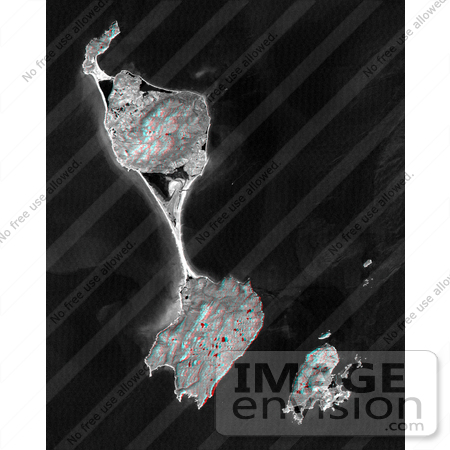
This anaglyph satellite image shows Miquelon and Saint Pierre Islands, located south of Newfoundland, Canada. These islands are a self-governing territory of France. A "tombolo" (sand bar) unites Grande Miquelon to the north and Petite Miquelon to the south. Saint Pierre Island, located to the lower right, includes a harbor, an airport, and a small town. Glaciers once covered these islands and the direction of glacial flow is evident in the topography as striations and shoreline trends running from the upper right to the lower left. The darkest image features are freshwater lakes that fill glacially carved depressions and saltwater lagoons that are bordered by barrier beaches. The lakes and the lagoons are fairly calm waters and reflect less sunlight than do the wave covered and sediment laden nearshore ocean currents. The stereoscopic effect was created by first draping a Landsat satellite image over preliminary digital elevation data from the Shuttle Radar Topography Mission (SRTM), and then generating two differing perspectives, one for each eye. When viewed through special glasses, the result is a vertically exaggerated view of the Earth's surface in its full three dimensions. Anaglyph glasses cover the left eye with a red filter and cover the right eye with a blue filter. Photo Credit: NASA/JPL/NIMA [0003-0701-0722-5259] by 0003
|
Keywords
3d, anaglyph, anaglyphs, canada, geography, grande miquelon, island, islands, jpl, miquelon and saint pierre islands, miquelon island, nasa, newfoundland, petite miquelon, saint pierre island, sand bar, tombolo
|
|


