
|
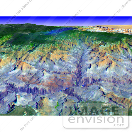
This simulated true color perspective view over the Grand Canyon was created from Advanced Spaceborne Thermal Emission and Reflection Radiometer (ASTER) data acquired on May 12th 2000. The Grand Canyon Village is in the lower foreground; the Bright Angel Trail crosses the Tonto Platform, before dropping down to the Colorado Village and then to the Phantom Ranch (green area across the river). Bright Angel Canyon and the North Rim dominate the view. At the top center of the image the dark blue area with light blue haze is an active forest fire. Photo Credit: NASA/GSFC/METI/ERSDAC/JAROS, and U.S./Japan ASTER Science Team [0003-0701-0712-0734] by 0003
|
Keywords
arizona, bright angel canyon, bright angel trail, canyon, canyons, colorado village, environment, environmental, fire, fires, forest fire, forest fires, geography, grand canyon, grand canyon village, jpl, nasa, north rim, phantom ranch, tonto platform
|
|


