
|
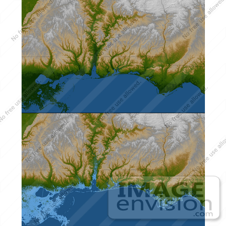
The topography of the Gulf Coast states is well shown in this color-coded shaded relief map generated with data from the Shuttle Radar Topography Mission. The image on the top (see Figure 1) is a standard view showing southern Louisiana, Mississippi, Alabama and the panhandle of Florida. Green colors indicate low elevations, rising through yellow and tan, to white at the highest elevations. For the view on the bottom (see Figure 2), elevations below 10 meters (33 feet) above sea level have been colored light blue. These low coastal elevations are especially vulnerable to flooding associated with storm surges. Planners can use data like these to predict which areas are in the most danger and help develop mitigation plans in the event of particular flood events. Photo Credit: NASA/JPL/NGA [0003-0701-0101-3358] by 0003
|
Keywords
alabama, eart science, florida, florida panhandle, geography, gulf, gulf coast, jpl, louisiana, mississippi, nasa, panhandle of florida, topography
|
|


