
|
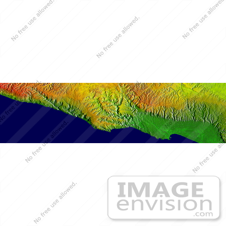
Image of Salalah, Oman. This elevation map shows a part of the southern coast of the Arabian Peninsula including parts of the countries of Oman and Yemen. The narrow coastal plain on the right side of the image includes the city of Salahlah, the second largest city in Oman. Various crops, including coconuts, papayas and bananas, are grown on this plain. The abrupt topography of the coastal mountains wrings moisture from the monsoon, enabling agriculture in the otherwise dry environment of the Arabian Peninsula. These mountains are historically significant as well: Some scholars believe these mountains are the "southern mountains" of the book of Genesis. Photo Credit: NASA/JPL/NIMA [0003-0701-0819-5908] by 0003
|
Keywords
arabian peninsula, geography, jpl, nasa, oman, salalah, salalah oman, yemen
|
|


