
|
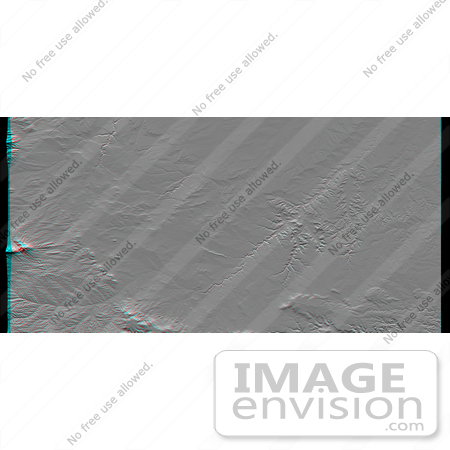
Erosional features are prominent in this view of southern Colorado taken by the Shuttle Radar Topography Mission (SRTM). The area covers about 20,000square kilometers and is located about 50 kilometers south of Pueblo, Colorado. The prominent mountains near the left edge of the image are the Spanish Peaks, remnants of a 20 million year old volcano. Rising 2,100 meters (7,000 feet) above the plains to the east, these igneous rock formations with intrusions of eroded sedimentary rock historically served as guiding landmarks for travelers on the Mountain Branch of the Santa Fe Trail. Near the center of the image is the Pinon Canyon Maneuver Site, a training area for soldiers of the U.S. Army from nearby Fort Carson. The site supports a diverse ecosystem with large numbers of big and small game, fisheries, non-game wildlife, forest, range land and mineral resources. It is bounded on the east by the dramatic topography of the Purgatoire River Canyon, a 100 meter (328 feet) deep scenic red canyon with flowing streams, sandstone formations and exposed geologic processes. This anaglyph was produced by first shading a preliminary SRTM elevation model. The stereoscopic effect was then created by generating two differing perspectives, one for each eye. When viewed through special glasses, the result is a vertically exaggerated view of the Earth's surface in its full three dimensions. Anaglyph glasses cover the left eye with a red filter and cover the right eye with a blue filter. Photo Credit: NASA/JPL/NIMA [0003-0701-0712-0947] by 0003
|
Keywords
3d, anaglyph, anaglyphs, colorado, geography, jpl, mountain branch, nasa, pinon canyon, pinon canyon maneuver site, pinon canyon region, pueblo, pueblo colorado, purgatoire river canyon, santa fe trail, spanish peaks
|
|


