|
TERMS OF USE:
This free image can only be used for non-commercial, personal
website use only. THIS IMAGE CANNOT BE
used in galleries, downloaded to your computer, posted on sites for
others to use, manipulated, downsized, or upsized. If you are confused about the
terms of use or have any questions then contact us before using the image.
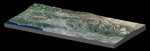
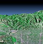
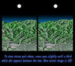
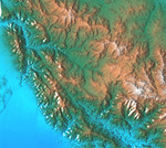
Free Picture: San Gabriel Mountains
|
Description
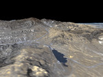
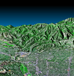
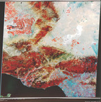
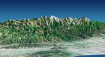
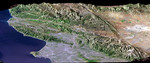
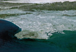
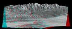
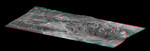
Image of the San Gabriel Mtns, Calif. This topographic image shows the relationship of the urban area of Pasadena, California to the natural contours of the land. The image includes the alluvial plain on which Pasadena and the Jet Propulsion Laboratory sit, and the steep range of the San Gabriel Mountains. The mountain front and the arcuate valley running from upper left to the lower right are active fault zones, along which the mountains are rising. The chaparral-covered slopes above Pasadena are also a prime area for wildfires and mudslides. Hazards from earthquakes, floods and fires are intimately related to the topography in this area. Topographic data and other remote sensing images provide valuable information for assessing and mitigating the natural hazards for cities along the front of active mountain ranges.
Keywords
ca, california, geography, jet propulsion laboratory, jpl, pasadena california, san gabriel mountains, san gabriel mtns, nasa, free photography, free photo, free photos, free picture, free pictures, free image, free images
|
Similar Free Pictures of san gabriel mountains
|
|
|
|