|
TERMS OF USE:
This free image can only be used for non-commercial, personal
website use only. THIS IMAGE CANNOT BE
used in galleries, downloaded to your computer, posted on sites for
others to use, manipulated, downsized, or upsized. If you are confused about the
terms of use or have any questions then contact us before using the image.
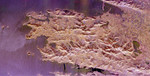
Free Picture: County Kerry From Space
|
Description
Image of Iveragh Peninsula, southwestern Ireland. The lakes of Killarney National Park are the green patches on the left side of the image. The mountains to the right of the lakes include the highest peaks (1,036 meters or 3,400 feet) in Ireland. The patchwork patterns between the mountains are areas of farming and grazing. The delicate patterns in the water are caused by refraction of ocean waves around the peninsula edges and islands, including Skellig Rocks at the right edge of the image. The Skelligs are home to a 15th century monastery and flocks of puffins. The region is part of County Kerry and includes a road called the "Ring of Kerry" that is one of the most famous tourist routes in Ireland.
Keywords
county kerry, county kerry from space, geography, ireland, iveragh peninsula, jpl, killarney national park, ring of kerry, skellig rocks, view from space, nasa, free photography, free photo, free photos, free picture, free pictures, free image, free images
|
Similar Free geography Pictures
|
|
|
|


