|
TERMS OF USE:
This free image can only be used for non-commercial, personal
website use only. THIS IMAGE CANNOT BE
used in galleries, downloaded to your computer, posted on sites for
others to use, manipulated, downsized, or upsized. If you are confused about the
terms of use or have any questions then contact us before using the image.
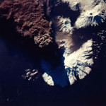
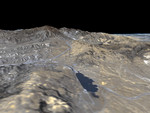
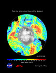
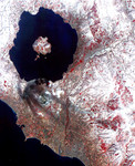
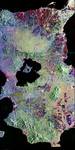
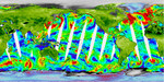
Free Picture: NASA's Newest SeaWinds Instrument Breezes Into Operation
|
Description
One of NASA's newest Earth-observing instruments, the SeaWinds scatterometer aboard Japan's Advanced Earth Observing Satellite (Adeos) 2--now renamed Midori 2--has successfully transmitted its first radar data to our home planet, generating its first high-quality images. From its orbiting perch high above Earth, SeaWinds on Midori 2 ('midori' is Japanese for the color green, symbolizing the environment) will provide the world's most accurate, highest resolution and broadest geographic coverage of ocean wind speed and direction, sea ice extent and properties of Earth's land surfaces. It will complement and eventually replace an identical instrument orbiting since June 1999 on NASA's Quick Scatterometer (QuikScat) satellite. Its three- to five-year mission will augment a long-term ocean surface wind data series that began in 1996 with launch of the NASA Scatterometer on Japan's first Adeos spacecraft. Climatologists, meteorologists and oceanographers will soon routinely use data from SeaWinds on Midori 2 to understand and predict severe weather patterns, climate change and global weather abnormalities like El Niño. The data are expected to improve global and regional weather forecasts, ship routing and marine hazard avoidance, measurements of sea ice extent and the tracking of icebergs, among other uses. 'Midori 2, its SeaWinds instrument and associated ground processing systems are functioning very smoothly,' said Moshe Pniel, scatterometer projects manager at NASA's Jet Propulsion Laboratory, Pasadena, Calif. "Following initial checkout and calibration, we look forward to continuous operations, providing vital data to scientists and weather forecasters around the world." "These first images show remarkable detail over land, ice and oceans," said Dr. Michael Freilich, Ocean Vector Winds Science Team Leader, Oregon State University, Corvallis, Ore. "The combination of SeaWinds data and measurements from other instruments on Midori 2 with data from other international
Keywords
earth science, jpl, nasa, ocean wind speed, weather, wind direction, wind speed, seawinds, free photography, free photo, free photos, free picture, free pictures, free image, free images
|
Similar Free earth science Pictures
|
|
|
|