|
TERMS OF USE:
This free image can only be used for non-commercial, personal
website use only. THIS IMAGE CANNOT BE
used in galleries, downloaded to your computer, posted on sites for
others to use, manipulated, downsized, or upsized. If you are confused about the
terms of use or have any questions then contact us before using the image.
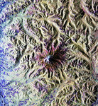
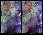
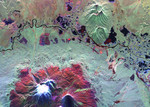
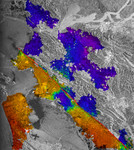
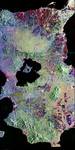
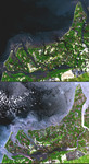
Free Picture: Shrimp Farms, Ecuador
|
Description
Image of Shrimp Farms, Ecuador from space. In many parts of the world, wetlands are being converted to shrimp ponds in order to farm these crustaceans for food and sale. One example is on the west coast of Ecuador, south of Guayaquil. The 1991 Landsat image on top shows a coastal area where 143 square kilometers of wetlands were converted to shrimp ponds. By the time ASTER acquired the bottom image in 2001, 243 square kilometers had been converted, eliminating 83% of the wetlands. These scenes cover an area of 30 x 31 km, and are centered near 3.4 degrees south latitude and 80.2 degrees west longitude.
Keywords
agricultural, agriculture, earth science, ecuador, ecuador agriculture, from space, jpl, nasa, shrimp farm, shrimp farming, shrimp ponds, view from space, wetlands, shrimp farms, free photography, free photo, free photos, free picture, free pictures, free image, free images
|
Similar Free earth science Pictures
|
|
|
|