-
Storm Clouds In A Blue Sky
-
Palm Trees And A Storm Over A House
-
Hurricane Ike Located Southeast Of Galveston Texas Moving Toward The West-Northwest At About 13 Mph ...
-
Hurricane Ike On September 12th 2008
-
Hurricane Ike Baring Down Over The Gulf Coast On September 12th 2009
-
Tropical Storm Hanna South-Southeast Of Wilmington North Carolina
-
Hurricane Bertha Traveling Northward At 10 Knots 115 Miles Per Hour Across The Eastern Part Of The C...
-
Tropical Cyclone Nargis Centered Near A Point Located At 15 3 Degrees North Latitude And 882 Degrees...
-
The Eye And Center Of Tropical Cyclone Nargis Seen When The Storm Was At Approximately 135 Degrees N...
-
Hurricane Bertha Traveling Northward At 10 Knots 115 Miles Per Hour Across The Eastern Part Of The C...
-
Hurricane Bertha To The East Of The Northern Leeward Islands Moving Toward The West-Northwest At Abo...
-
Hurricane Boris To The West-Southwest Of The Southern Tip Of Baja California And Moving Toward The W...
-
Tropical Storms Bud And Dera
-
Hurricane Debby And The Appalachians
-
Extratropical Cyclone In The Southern Ocean
-
Hurricane Juliette
-
Hurricane Lili Heads For Louisiana Landfall
-
Hurricanes Frances And Ivan
-
Aspects Of Hurricane Isabel
-
Typhoon Mawar
-
Wilma
-
Typhoon Nari Approaches China
-
Roiling Clouds Of Katrina
-
A Strengthening Eastern Pacific Storm
-
Tracking Hurricane Wilma Across The Caribbean
-
Airs Storm Front Approaching California
 Storm Clouds In A Blue Sky
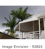 Palm Trees And A Storm Over A House
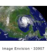 Hurricane Ike Located Southeast Of Galveston Texas Moving Toward The West-Northwest At About 13 Mph ...
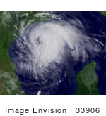 Hurricane Ike On September 12th 2008
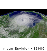 Hurricane Ike Baring Down Over The Gulf Coast On September 12th 2009
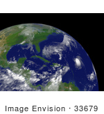 Tropical Storm Hanna South-Southeast Of Wilmington North Carolina
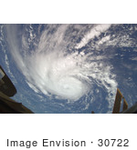 Hurricane Bertha Traveling Northward At 10 Knots 115 Miles Per Hour Across The Eastern Part Of The C...
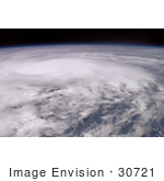 Tropical Cyclone Nargis Centered Near A Point Located At 15 3 Degrees North Latitude And 882 Degrees...
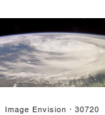 The Eye And Center Of Tropical Cyclone Nargis Seen When The Storm Was At Approximately 135 Degrees N...
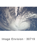 Hurricane Bertha Traveling Northward At 10 Knots 115 Miles Per Hour Across The Eastern Part Of The C...
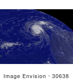 Hurricane Bertha To The East Of The Northern Leeward Islands Moving Toward The West-Northwest At Abo...
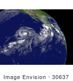 Hurricane Boris To The West-Southwest Of The Southern Tip Of Baja California And Moving Toward The W...
 Tropical Storms Bud And Dera
 Hurricane Debby And The Appalachians
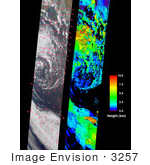 Extratropical Cyclone In The Southern Ocean
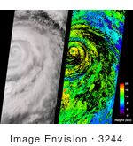 Hurricane Juliette
 Hurricane Lili Heads For Louisiana Landfall
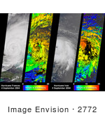 Hurricanes Frances And Ivan
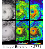 Aspects Of Hurricane Isabel
 Typhoon Mawar
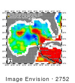 Wilma
Wilma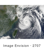 Typhoon Nari Approaches China
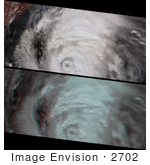 Roiling Clouds Of Katrina
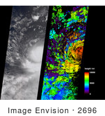 A Strengthening Eastern Pacific Storm
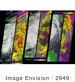 Tracking Hurricane Wilma Across The Caribbean
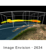 Airs Storm Front Approaching California