
|
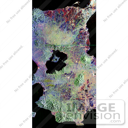
NASA image of Taal volcano, near Manila on the island of Luzon in the Philippines. The black area in the center is Taal Lake, which nearly fills the 30-kilometer-diameter (18-mile) caldera. The caldera rim consists of deeply eroded hills and cliffs. The large island in Taal Lake, which itself contains a crater lake, is known as Volcano Island. The bright yellow patch on the southwest side of the island marks the site of an explosion crater that formed during a deadly eruption of Taal in 1965. Photo Credit: NASA/JPL [0003-0701-0820-0125] by 0003
|
Keywords
earth science, geography, island of luzon, jpl, luzon, luzon island, nasa, philippines, taal, taal lake, taal volcano, volcano, volcano island, volcanoes
|
|


