
|
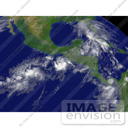
Photo of Tropical Depression Barbara south of Tehuantepec, moving toward the east at 4 knots with maximum sustained winds at 30 knots and gusts up to 40 knots, June 1st 2007. Centerpoint Latitude: 13:16:36N Longitude: 94:22:38W. [0003-0709-0615-4052] by 0003
|
Keywords
barbara, cyclone, cyclones, earth, earth from space, from space, hurricane, hurricanes, national oceanic and atmospheric administration, nature, noaa, storm, storms, tehuantepec, tropical cyclone, tropical cyclones, tropical depression, tropical depression barbara, tropical depressions, tropical storm, tropical storms, view from space, weather
|
|


