
|
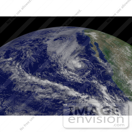
Royalty-free weather stock photo of Tropical Storm Gil west of Guadalajara, moving toward the west at 8 knots with maximum sustained winds at 35 knots, and gusts up to 45 knots, August 30th 2007. Centerpoint Latitude: 19:30:37N Longitude: 113:55:17W. [0003-0709-0615-4079] by 0003
|
Keywords
cyclone, cyclones, earth, earth from space, from space, gil, guadalajara, hurricane, hurricanes, national oceanic and atmospheric administration, nature, noaa, storm, storms, tropical cyclone, tropical cyclones, tropical storm, tropical storm gil, tropical storms, view from space, weather
|
|


