
|
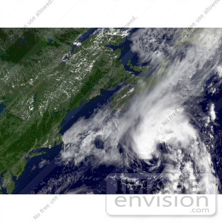
Photo of Tropical Storm Chantal moving off the coast of New England and Nova Scotia, July 31st 2007. Centerpoint Latitude: 41:19:58N Longitude: 63:04:52W. [0003-0709-0615-4033] by 0003
|
Keywords
chantal, cyclone, cyclones, earth, earth from space, from space, hurricane, hurricanes, national oceanic and atmospheric administration, nature, new england, noaa, nova scotia, storm, storms, tropical cyclone, tropical cyclones, tropical storm, tropical storm chantal, tropical storms, view from space, weather
|
|


