
|
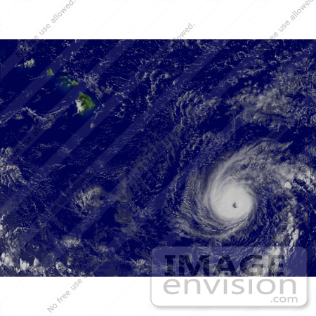
Photo of Hurricane Flossie near Hawaii (top left), 600 miles southeast of Hilo, Hawaii, with maximum sustained winds at 135 mph, August 13th 2007. Centerpoint Latitude: 14:00:28N Longitude: 146:30:48W. [0003-0709-0614-0452] by 0003
|
Keywords
cyclone, cyclones, earth, earth from space, flossie, flossie hurricane, from space, hawaii, hurricane, hurricane flossie, hurricanes, national oceanic and atmospheric administration, nature, noaa, storm, storms, tropical cyclone, tropical cyclones, tropical storm, tropical storms, view from space, weather
|
|


