
|
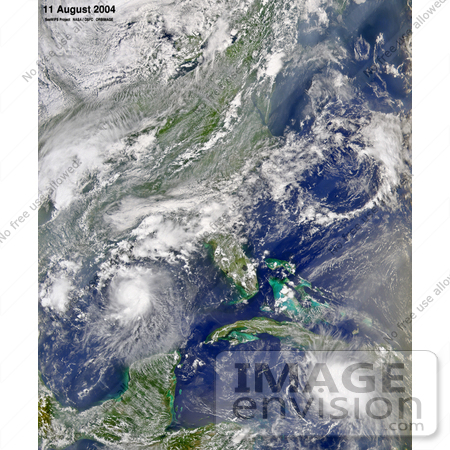
The Sea-viewing Wide Field-of-view Sensor (SeaWiFS) aboard the OrbView-2 satellite captured this true-color image of Tropical Storm Bonnie in the Gulf of Mexico and Hurricane Charley in the Caribbean Sea on August 11, 2004, at 2 p.m. EDT. At the time this image was taken, Bonnie had maximum sustained winds of 105 km per hour (65 mph) while Charley had just reached hurricane strength with maximum sustained winds of 120 km per hour (75 mph). Photo Credit: NASA/Orbimage [0003-0701-0100-0449] by 0003
|
Keywords
bonnie, caribbean sea, charley, gulf of mexico, hurricane charley, nasa, nature, storm, storm bonnie, storm charley, storms, tropical storm, tropical storm bonnie, tropical storm charley, tropical storms, tropical storms bonnie and charley, weather
|
|


