
|
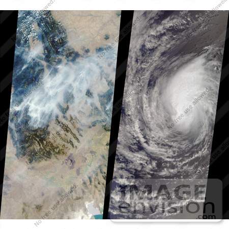
NASA images of Montana forest fires and Hurricane Hector in the Pacific, 2000. In the left image, huge smoke plumes rise from devastating wildfires in the Bitterroot Mountain Range near the Montana-Idaho border. Flathead Lake is near the upper left, and the Great Salt Lake is at the bottom right. Smoke accumulating in the canyons and plains is also visible. The wide extent of the smoke is evident from comparison with the image on the right. When this image of Hector was taken, the eastern Pacific tropical cyclone was located approximately 1,100 kilometers (680 miles) west of the southern tip of Baja California, Mexico. The eye is faintly visible and measures 25 kilometers (16 miles) in diameter. The storm was beginning to weaken, and 24 hours later the National Weather Service downgraded Hector from a hurricane to a tropical storm. Photo Credit: NASA/GSFC/JPL, MISR Team [0003-0701-0820-1235] by 0003
|
Keywords
bitterroot mountain range near, earth science, fire, fires, flathead lake, forest fire, forest fires, great salt lake, hurricane, hurricane hector, hurricanes, jpl, montana, montana fires, nasa, weather, wild fire, wild fires, wildfire, wildfires
|
|


