
|
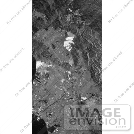
This is a radar image of Los Angeles, California, taken on October 2nd 1994. Visible in the image are Long Beach Harbor at the bottom right (south corner of the image), Los Angeles International Airport at the bottom center, with Santa Monica just to the left of it and the Hollywood Hills to the left of Santa Monica. Also visible in the image are the freeway systems of Los Angeles, which appear as dark lines. The San Gabriel Mountains (center top) and the communities of San Fernando Valley, Simi Valley and Palmdale can be seen on the left-hand side. Photo Credit: NASA/JPL-Caltech [0003-0701-0820-1128] by 0003
|
Keywords
ca, cali, calif, california, geography, hollywood hills, jpl, la, long beach harbor, los angeles, los angeles international airport, nasa, palmdale, san fernando valley, san gabriel mountains, san gabriel mtns, santa monica, simi valley
|
|


