
|
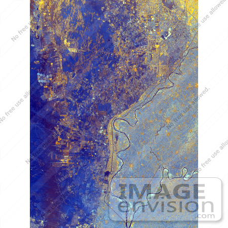
Radar image of the area just north of the city of Cairo, Egypt, where the Nile River splits into two main branches. The Rosetta Branch is the curving dark line in the center of the image and the Damietta Branch is the curving dark line in the lower right of the image. The light blue area on the right half of the image is a portion of the Nile River Delta. The thinner, straighter lines and the small network of gold lines are irrigation canals. There are more than 10,000 kilometers of canals throughout the Nile Delta. A transition zone of irrigated fields is shown in blue and yellow between the irrigated delta and the surrounding desert. The desert is the dark blue area on the left side of the image lacking the pattern of irrigated fields. Photo Credit: NASA/JPL [0003-0701-1019-1949] by 0003
|
Keywords
damietta branch, delta, egypt, from space, geography, jpl, nasa, nile delta, nile river, nile river delta, nile river delta from space, river, rosetta branch, view from space
|
|


