
|
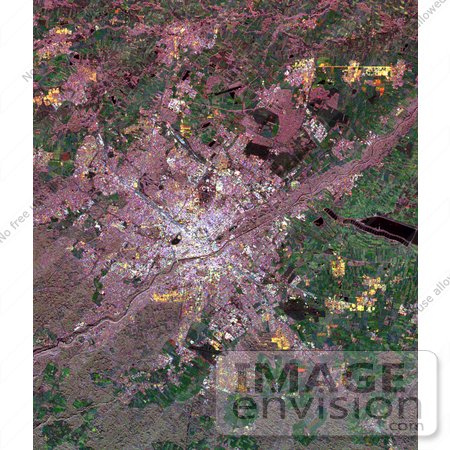
Image of Munich, Germany from space. Central Munich is the white area at the middle of the image, on the banks of the Isar River. Pink areas are forested, while green areas indicate clear-cut and agricultural terrain. The Munich region served as a primary "supersite" for studies in ecology, hydrology and radar calibration during the Spaceborne Imaging Radar-C/X-Band Synthetic Aperture Radar (SIR-C/X-SAR) missions. Scientists were able to use these data to map patterns of forest damage from storms and areas affected by bark beetle infestation. Photo Credit: NASA/JPL [0003-0701-1019-1850] by 0003
|
Keywords
bavaria, central munich, from space, geography, germany, isar river, jpl, munich, munich from space, munich germany, munich germany from space, nasa, view from space
|
|


