
|
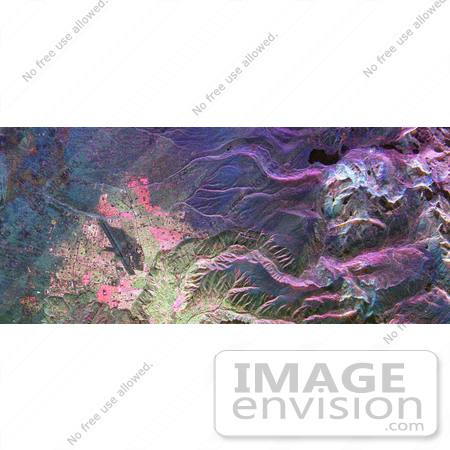
NASA image of La Paz, Bolivia from space. This is an image of the Bolivian capital city of La Paz that was created using three radar frequencies. La Paz sits at the edge of the Altiplano, the high inland plateau between the Cordillera Occidental and Cordillera Oriental belts of the Andes Mountains in South America. Part of the Cordillera Oriental mountains are seen on the right side (northeast) of this image. The bright areas at the top of the mountains are most likely the result of year-round snow cover. Glacier-carved valleys drain the mountain areas. The dark lines left of center are Kennedy Airport near the northwestern part of the city. Photo Credit: NASA/JPL [0003-0701-1019-1208] by 0003
|
Keywords
altiplano, andes mountains, bolivia, bolivia from space, cordillera oriental, cordillera oriental mountains, from space, geography, jpl, kennedy airport, la paz, la paz bolivia, la paz from space, nasa, view from space
|
|


