
|
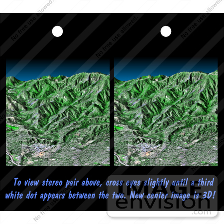
Image of the San Gabriel Mtns, Pasadena, California. This stereoscopic image pair is a perspective view that shows the western part of the city of Pasadena, California, looking north toward the San Gabriel Mountains. Portions of the cities of Altadena and La Canada Flintridge are also shown. The cluster of large buildings left of center, at the base of the mountains, is the Jet Propulsion Laboratory. This image shows the power of combining data from different sources to create planning tools to study problems that affect large urban areas. In addition to the well-known earthquake hazards, Southern California is affected by a natural cycle of fire and mudflows. Data shown in this image can be used to predict both how wildfires spread over the terrain and how mudflows are channeled down the canyons. Photo Credit: NASA/JPL/NIMA [0003-0701-0820-1547] by 0003
|
Keywords
altadena, california, geography, jet propulsion laboratory, jpl, la canada flintridge, nasa, pasadena, pasadena california, san gabriel mountains, san gabriel mtns
|
|


