
|
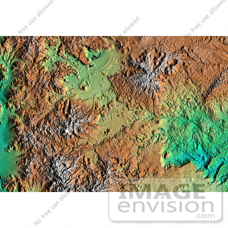
Topographic image of Patagonia, Argentina showing a landscape formed by volcanoes, rivers, and wind. The area is located just east of the narrow range of the Andes Mountains, about 100 kilometers (62 miles) east of the border with Chile. Interesting features include basalt-capped mesas with sinkholes (lower center), arcuate ridges of windblown beach sands downwind from a salty desert lake (upper center), young volcanic cones(right), and at least one case of what geologists call "inverted relief". This happens when lava flows down a valley in soft material and then the soft material is eroded away leaving the former valley as a ridge of lava. These ridges can be seen on the slopes of the volcano in the upper right. Photo Credit: NASA/JPL/NIMA [0003-0701-0820-1417] by 0003
|
Keywords
argentina, geography, jpl, nasa, patagonia, patagonia argentina
|
|


