
|
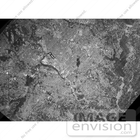
The Dallas-Fort Worth metropolitan area in Texas is shown on this image collected by the C-band radar of the Shuttle Radar Topography Mission (SRTM). On this radar image, smooth areas, such as lakes, roads and airport runways appear dark. Rougher features, such as buildings and trees, appear bright. Downtown Dallas is the bright area at the center of the image, alongside the dark linear floodway of the Trinity River. Dark linear runways of two airports are also seen: Love Field near downtown Dallas in the image center, and Dallas-Fort Worth International Airport in the upper left corner. The semi-circular terminal buildings of the international airport can also be seen in the area between the runways. Several large lakes, including Lake Ray Hubbard (upper right) and Joe Pool Lake (lower left) are also seen. Photo Credit: NASA/JPL/NIMA [0003-0701-0819-4841] by 0003
|
Keywords
dallas, dallas-fort worth, dallas-fort worth international airport, fort worth, geography, joe pool lake, jpl, lake ray hubbard, love field, love field airport, nasa, texas, trinity river, tx
|
|


