
|
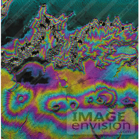
Island nations in the South Pacific Ocean experience natural disasters associated with typhoons, and with their proximity to the Pacific Ocean's "Ring of Fire." This radar image shows the western end of the island of Upolu in the nation of Western Samoa. Disaster managers use digital elevation models (DEMs) generated from radar data to assist in research toward disaster mitigation and management. Geologists also use DEM data of volcanic features, such as the circular craters in this image, to study eruption rates and volumes, and volcanic landform evolution. Black areas near the top of the image are areas where steep topography causes holes in the data; these holes can be filled in by collecting data at other look directions. Color represents topography and intensity represents across-section of the radar backscatter. Since rough areas return more of the incident signal, they appear brighter on the image than relatively smooth areas, such as the ocean surface at the top of the image. Photo Credit: NASA/JPL [0003-0701-0722-4824] by 0003
|
Keywords
apia, geography, jpl, nasa, radar image, radar images, ring of fire, samoa, upolu island, western samoa
|
|


