
|
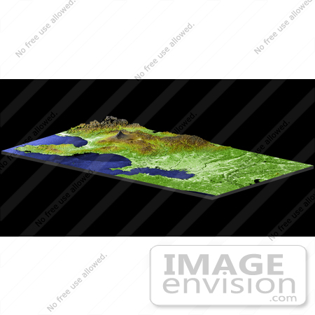
Tokyo, located on the island of Honshu, is Japan's capital and most populous city. In this perspective view generated using data from the Shuttle Radar Topography Mission (SRTM), Tokyo appears as the large, bright area in the foreground. The metropolitan area is home to one-fourth of Japan's 127 million people. First known as Edo, the now bustling metropolis first began to flourish in 1603 when a Shogunate (a region under the jurisdiction of a military leader) was established there. Like all of Japan's major cities it is located in the flat, coastal areas of this mostly rugged and mountainous country. The mountain peak in the background is the 3,776-meter(12,388-feet) high Mt. Fuji. A world-famous stratovolcano, Fuji is still considered active despite not having had an eruption in almost 300 years. In this image, elevations are represented by color; height increases from white to green to brown. For visualization purposes, topographic heights displayed in this image are exaggerated two times. Photo Credit: NASA/JPL/NIMA [0003-0701-0722-4528] by 0003
|
Keywords
fuji, geography, honshu, japan, jpl, mount fuji, mountain, mt fuji, nasa, tokyo, tokyo japan
|
|


