
|
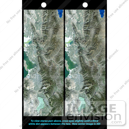
The 2002 Winter Olympics are hosted by Salt Lake City at several venues within the city, in nearby cities, and within the adjacent Wasatch Mountains. This image pair provides a stereoscopic map view of north central Utah that includes all of these Olympic sites. In the south, next to Utah Lake, Provo hosts the ice hockey competition. In the north, northeast of the Great Salt Lake, Ogden hosts curling and the nearby Snowbasin ski area hosts the downhill events. In between, southeast of the Great Salt Lake, Salt Lake City hosts the Olympic Village and the various skating events. Further east, across the Wasatch Mountains, the Park City ski resort hosts the bobsled, ski jumping, and snowboarding events. The Winter Olympics are always hosted in mountainous terrain. This view shows the dramatic landscape that makes the Salt Lake City region a world-class center for winter sports. This stereoscopic image was generated by draping a Landsat satellite image over a Shuttle Radar Topography Mission digital elevation model. Two differing perspectives were then calculated, one for each eye. They can be seen in 3-D by viewing the left image with the right eye and the right image with the left eye (cross-eyed viewing or by downloading and printing the image pair and viewing them with a stereoscope. When stereoscopically merged, the result is a vertically exaggerated view of Earth's surface in its full three dimensions. Photo Credit: NASA/JPL/NIMA [0003-0701-0214-1116] by 0003
|
Keywords
3d, geography, great salt lake, jpl, lake, lakes, nasa, ogden, olympic village, park city ski resort, provo, salt lake city, salt lake city ut, salt lake city utah, slc, ut, utah, wasatch mountains
|
|


