
|
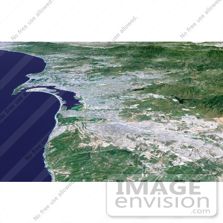
The influence of topography on the growth of the city of San Diego is seen clearly in this computer-generated perspective viewed from the south. The Peninsular Ranges to the east of the city have channeled development of the cities of La Mesa and El Cajon, above the center. San Diego itself clusters around the bay enclosed by Point Loma and Coronado Island. In the mountains to the right, Lower Otay Lake and Sweetwater Reservoir are the dark patches. This 3-D perspective view was generated using topographic data from the Shuttle Radar Topography Mission (SRTM) and an enhanced color Landsat 5satellite image. Topographic expression is exaggerated two times. Photo Credit: NASA/JPL/NIMA [0003-0701-0121-3743] by 0003
|
Keywords
3d, ca, cali, calif, california, city, coronado island, el cajon, geography, jpl, la mesa, lower otay lake, nasa, peninsular ranges, point loma, san diego, san diego ca, san diego cali, san diego calif, san diego california, sweetwater reservoir
|
|


