
|
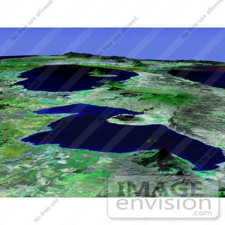
This perspective view shows Lakes Managua and Nicaragua near the Pacific coast of Nicaragua. Lake Managua is the 65-kilometer (40-mile)-long fresh water lake in the foreground of this south-looking view, emptying via the Tipitapa River into the much larger Lake Nicaragua in the distance. The capital city of Managua, with a population of more than 500,000, is located along the southern shore of Lake Managua, the area with the highest population density in Nicaragua. The physical setting of Lake Managua is dominated by the numerous volcanic features aligned in a northwest-southeast axis. The cone-like feature in the foreground is Momotombo, a 1,280-meter (4,199-foot)-high stratovolcano located on the northwest end of the lake. Two water-filled volcanic craters (Apoyegue and Jiloa volcanoes) reside on the Chiltepe Peninsula protruding into the lake from the west. Two volcanoes can also be seen on the island of Ometepe in Lake Nicaragua: El Maderas rising to 1,394 meters (4,573 feet) and the active El Conception at 1,610 meters (5,282 feet). Photo Credit: NASA/JPL-Caltech [0003-0701-0121-2207] by 0003
|
Keywords
apoyegue and jiloa volcanoes, apoyegue volcano, chiltepe peninsula, el conception, el maderas, geography, island ometepe, jiloa volcano, jpl, lake, lake managua, lake nicaragua, lakes, lakes managua and nicaragua, managua, managua lake, momotombo, nasa, nicaragua, nicaragua lake, ometepe, ometepe island, tipitapa river
|
|


