
|
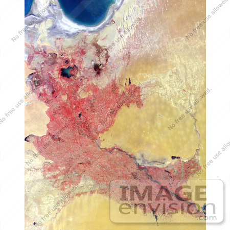
This false-color image was acquired by the Multi-angle Imaging SpectroRadiometer (MISR) in late June, 2002, and represents an area of about 292 kilometers x 370 kilometers. Data from the near-infrared, red and blue spectral bands of MISR's downward-viewing (nadir) camera are displayed as red, green and blue, respectively, causing highly vegetated areas to appear red. Photo Credit: NASA/GSFC/LaRC/JPL, MISR Team [0003-0612-3120-0943] by 0003
|
Keywords
geography, jpl, nasa, northeastern turkmenistan, turkmenistan, uzbekistan, western uzbekistan, western uzbekistan and northeastern turkmenistan
|
|


