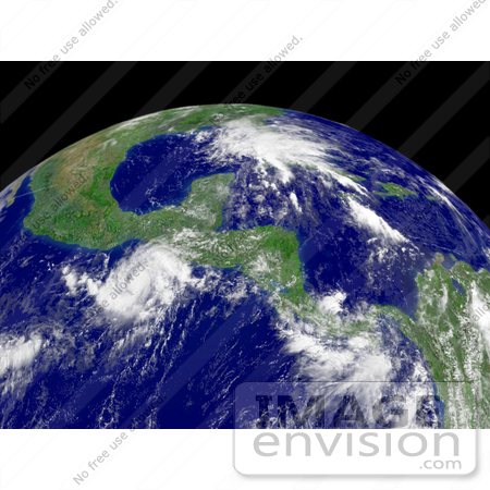
Stock Photo of Tropical Depression Barbara Near Guatemala #15420


#15420 Stock Photo of Tropical Depression Barbara Near Guatemala by JVPD
Royalty-free weather stock photo of Tropical Depression Barbara located about 185 miles SW of Guatemala, moving toward the east at 4 knots with maximum sustained winds at 45 mph, June 1st 2007. Centerpoint Latitude: 14:39:02N Longitude: 86:58:2. [0003-0709-0615-4068] by 0003

Similar Images:

#15409 Picture of Tropical Depression Erin by JVPD
#15427 Picture of Tropical Depression 10E Near Guadalajara by JVPD
#15407 Picture of Tropical Depression Erin Over Texas by JVPD
#15375 Picture of Tropical Depression 03E by JVPD
#15408 Picture of Tropical Depression Erin Near Corpus Christi by JVPD
#15344 Picture of Tropical Depression Felix by JVPD
#15374 Picture of Tropical Depression 03E by JVPD
#15397 Picture of Tropical Depression Five by JVPD
#10467 Picture of Tropical Depression Bill by JVPD
#15424 Stock Photo of Tropical Depression Dean by JVPD
#15404 Picture of Tropical Depression 04E Near Mexico by JVPD
#15376 Picture of Tropical Depression 03E Near Mexico by JVPD
#15411 Picture of Tropical Depression Barbara by JVPD
#15405 Picture of Tropical Depression 04 by JVPD
More Tropical Depression Photos

Keywords

barbara, cyclone, cyclones, earth, earth from space, from space, guatemala, hurricane, hurricanes, national oceanic and atmospheric administration, nature, noaa, storm, storms, tropical cyclone, tropical cyclones, tropical depression, tropical depression barbara, tropical depressions, tropical storm, tropical storms, view from space, weather