
|
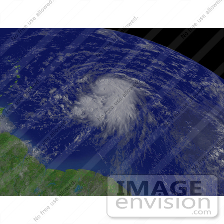
Royalty-free weather stock photo of Tropical Storm Dean east of Barbados, moving toward the west near 24 MPH with maximum sustained winds at 80 MPH and higher gusts, August 16th 2007. Centerpoint Latitude: 13:17:55N Longitude: 53:07:05W. [0003-0709-0615-4063] by 0003
|
Keywords
barbados, cyclone, cyclones, dean, earth, earth from space, from space, hurricane, hurricanes, national oceanic and atmospheric administration, nature, noaa, storm, storms, tropical cyclone, tropical cyclones, tropical storm, tropical storm dean, tropical storms, view from space, weather
|
|


