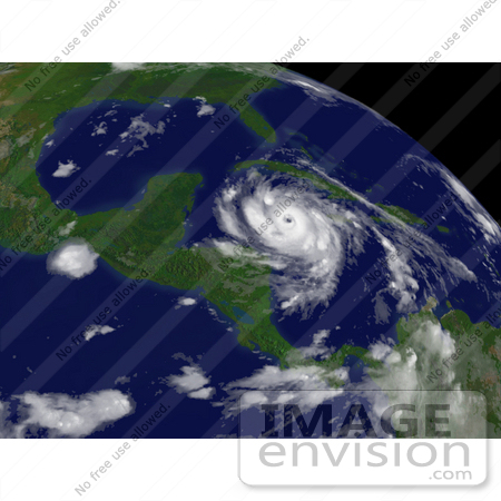
Picture of Hurricane Dean to the East of Belize City #15356


#15356 Picture of Hurricane Dean to the East of Belize City by JVPD
Hurricane Dean to the east of Belize City, moving toward the west at about 21 MPH with maximum sustained winds close to 150 MPH, August 20th 2007. Centerpoint Latitude: 17:45:21N Longitude: 81:25:28W. [0003-0709-0613-3244] by 0003

Similar Images:

#15357 Picture of Hurricane Dean East-Southeast of Campeche, Mexico by JVPD
#15349 Picture of Hurricane Dean by JVPD
#15352 Picture of Hurricane Dean by JVPD
#15360 Picture of Hurricane Dean in the Bay of Campeche by JVPD
#15351 Picture of Hurricane Dean Near San Juan by JVPD
#15350 Picture of Hurrican Dean Near Martinique by JVPD
#15359 Picture of Hurricane Dean by the Yucatan Peninsula by JVPD
#15348 Picture of Hurricane Dean by JVPD
#15358 Picture of Hurricane Dean by JVPD
#15363 Picture of Hurricane Dean Hitting the Yucatan Peninsula by JVPD
#15354 Picture of Hurricane Dean in the Atlantic Ocean by JVPD
#15361 Picture of Hurricane Dean Near Tuxpan, Mexico by JVPD
#15362 Picture of Hurricane Dean as a Category 3 Hurricane by JVPD
#15347 Picture of Hurricane Dean Near the Yucatan Peninsula by JVPD
More Hurricane Dean Photos

Keywords

belize city, cyclone, cyclones, dean, dean hurricane, earth, earth from space, from space, hurricane, hurricane dean, hurricanes, national oceanic and atmospheric administration, nature, noaa, storm, storms, tropical cyclone, tropical cyclones, tropical storm, tropical storms, view from space, weather