
|
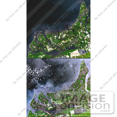
Image of Shrimp Farms, Ecuador from space. In many parts of the world, wetlands are being converted to shrimp ponds in order to farm these crustaceans for food and sale. One example is on the west coast of Ecuador, south of Guayaquil. The 1991 Landsat image on top shows a coastal area where 143 square kilometers of wetlands were converted to shrimp ponds. By the time ASTER acquired the bottom image in 2001, 243 square kilometers had been converted, eliminating 83% of the wetlands. These scenes cover an area of 30 x 31 km, and are centered near 3.4 degrees south latitude and 80.2 degrees west longitude. Photo Credit: NASA/GSFC/METI/ERSDAC/JAROS, and U.S./Japan ASTER Science Team [0003-0612-3114-4016] by 0003
|
Keywords
agricultural, agriculture, earth science, ecuador, ecuador agriculture, from space, jpl, nasa, shrimp farm, shrimp farming, shrimp farms, shrimp ponds, view from space, wetlands
|
|


