|
TERMS OF USE:
This free image can only be used for non-commercial, personal
website use only. THIS IMAGE CANNOT BE
used in galleries, downloaded to your computer, posted on sites for
others to use, manipulated, downsized, or upsized. If you are confused about the
terms of use or have any questions then contact us before using the image.
Free Picture: Sea Winds
|
Description
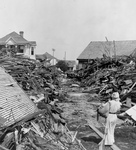
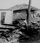
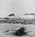
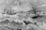
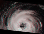
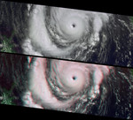
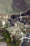
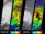
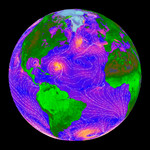
The SeaWinds scatterometer on the QuikSCAT satellite makes global radar measurements -- day and night, in clear sky and through clouds. The radar data over the oceans provide scientists and weather forecasters with information on surface wind speed and direction. Scientists also use the radar measurements directly to learn about changes in vegetation and ice extent over land and polar regions. This false-color image is based entirely on SeaWinds measurements obtained over oceans, land, and polar regions. Over the ocean, colors indicate wind speed with orange as the fastest wind speeds and blue as the slowest. White streamlines indicate the wind direction. The ocean winds in this image were measured by SeaWinds on September 20, 1999. The large storm in the Atlantic off the coast of Florida is Hurricane Gert. Tropical storm Harvey is evident as a high wind region in the Gulf of Mexico, while farther west in the Pacific is tropical storm Hilary. An extensive storm is also present in the South Atlantic Ocean near Antarctica. The land image was made from four days of SeaWinds data with the aid of a resolution enhancement algorithm developed by Dr. David Long at Brigham Young University. The lightest green areas correspond to the highest radar backscatter. Note the bright Amazon and Congo rainforests compared to the dark Sahara desert. The Amazon River is visible as a dark line running horizontally though the bright South American rain forest. Cities appear as bright spots on the images, especially in the U.S. and Europe. The image of Greenland and the north polar ice cap was generated from data acquired by SeaWinds on a single day. In the polar region portion of the image, white corresponds to the largest radar return, while purple is the lowest. The variations in color in Greenland and the polar ice cap reveal information about the ice and snow conditions present.
Keywords
earth science, geography, hurricane, hurricane gert, hurricanes, jpl, sea winds, seawinds, storm, storms, stropical storms, tropical storm, tropical storm harvey, tropical storm hilary, weather, nasa, free photography, free photo, free photos, free picture, free pictures, free image, free images
|
Similar Free hurricane Pictures
|
|
|
|