|
TERMS OF USE:
This free image can only be used for non-commercial, personal
website use only. THIS IMAGE CANNOT BE
used in galleries, downloaded to your computer, posted on sites for
others to use, manipulated, downsized, or upsized. If you are confused about the
terms of use or have any questions then contact us before using the image.
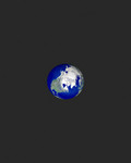
Free Picture: Global View of the Arctic Ocean
|
Description
NASA researchers have new insights into the mysteries of Arctic sea ice, thanks to the unique abilities of Canada's Radarsat satellite. The Arctic is the smallest of the world's four oceans, but it may play a large role in helping scientists monitor Earth's climate shifts. Using Radarsat's special sensors to take images at night and to peer through clouds, NASA researchers can now see the complete ice cover of the Arctic. This allows tracking of any shifts and changes, in unprecedented detail, over the course of an entire winter. The radar-generated, high-resolution images are up to 100 times better than those taken by previous satellites. Using this new information, scientists at NASA's Jet Propulsion Laboratory (JPL), Pasadena, Calif., can generate comprehensive maps of Arctic sea ice thickness for the first time. "Before we knew only the extent of the ice cover," said Dr. Ronald Kwok, JPL principal investigator of a project called Sea Ice Thickness Derived From High Resolution Radar Imagery. "We also knew that the sea ice extent had decreased over the last 20 years, but we knew very little about ice thickness." Until now, observations of polar sea ice thickness have been available for specific areas, but not for the entire polar region.
Keywords
arctic ocean, arctic sea ice, earth, geography, global view of the arctic ocean, jpl, ocean, oceans, nasa, free photography, free photo, free photos, free picture, free pictures, free image, free images
|
Similar Free geography Pictures
|
|
|
|


