|
TERMS OF USE:
This free image can only be used for non-commercial, personal
website use only. THIS IMAGE CANNOT BE
used in galleries, downloaded to your computer, posted on sites for
others to use, manipulated, downsized, or upsized. If you are confused about the
terms of use or have any questions then contact us before using the image.
Free Picture: Light of Day

|
Description
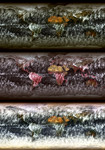
As of July 31, 2002, global multi-angle, multi-spectral radiance products are available from the MISR instrument aboard the Terra satellite. Measuring the radiative properties of different types of surfaces, clouds and atmospheric particulates is an important step toward understanding the Earth's climate system. These images are among the first planet-wide summary views to be publicly released from the Multi-angle Imaging SpectroRadiometer experiment. Data for these images were collected during the month of March 2002, and each pixel represents monthly-averaged daylight radiances from an area measuring 1/2 degree in latitude by 1/2 degree in longitude. The top panel is from MISR's nadir (vertical-viewing) camera and combines data from the red, green and blue spectral bands to create a natural color image. The central view combines near-infrared, red, and green spectral data to create a false-color rendition that enhances highly vegetated terrain. It takes 9 days for MISR to view the entire globe, and only areas within 8 degrees of latitude of the north and south poles are not observed due to the Terra orbit inclination. Because a single pole-to-pole swath of MISR data is just 400 kilometers wide, multiple swaths must be mosaiced to create these global views. Discontinuities appear in some cloud patterns as a consequence of changes in cloud cover from one day to another. The lower panel is a composite in which red, green, and blue radiances from MISR's 70-degree forward-viewing camera are displayed in the northern hemisphere, and radiances from the 70-degree backward-viewing camera are displayed in the southern hemisphere. At the March equinox (spring in the northern hemisphere, autumn in the southern hemisphere), the Sun is near the equator. Therefore, both oblique angles are observing the Earth in "forward scattering", particularly at high latitudes. Forward scattering occurs when you (or MISR) observe an object with the Sun at a point in the sky that is in front o
Keywords
climate, earth, earth climate, geography, jpl, map, maps, nasa, earths climate, free photography, free photo, free photos, free picture, free pictures, free image, free images
|
Similar Free geography Pictures
|
|
|
|